Controlled Source Electromagnetics
Controlled-source electromagnetic (CSEM) methods can overcome some types of artificial and natural electromagnetic interference by using a man-made transmitter instead of relying solely on natural signals.
Within this group of methods, a key distinction depends on the distance between the transmitter dipole and the receiver array. In far-field configurations, the transmitted signal can be approximated as a plane wave. In near-field configurations, the field geometry is more complex, and the data must be normalized to the transmitter strength and geometry.
Far-field methods — typically Controlled-Source Audio Magnetotellurics (CSAMT) — produce data similar to the AMT range, but with a controlled artificial source. To maintain far-field conditions, a sufficient distance must be preserved between the source dipole and the receiver line.
Near-field techniques, where the transmitted signal cannot be approximated as a plane wave, are actively being developed by several research groups. These approaches are conceptually closer to Controlled-Source Electromagnetic (CSEM) methods widely applied in marine geophysics.
The primary advantage of controlled-source methods is that the transmitted signal is fully controlled by the field crew, improving repeatability and often reducing sensitivity to certain types of interference. However, the achievable depth of investigation is generally more limited compared to natural-source MT. Another practical consideration is the requirement to deploy and operate a transmitter system in the field, which adds logistical complexity.
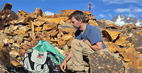 Data Acquisition
We provide comprehensive technical support at every stage of your field geophysical campaign — from logistics and operational management to data acquisition and crew supervision.
Data Acquisition
Data Acquisition
We provide comprehensive technical support at every stage of your field geophysical campaign — from logistics and operational management to data acquisition and crew supervision.
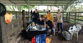 Training
On-site or remote courses, hands-on exercises, and crew ramp-up for consistent, repeatable results.
Training
Training
On-site or remote courses, hands-on exercises, and crew ramp-up for consistent, repeatable results.
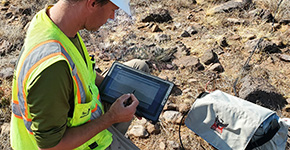 Data Processing
We deliver advanced field data processing and cleaning, including quality control and assessment, denoising, inversion, and preparation of geophysical maps.
Data Processing
Data Processing
We deliver advanced field data processing and cleaning, including quality control and assessment, denoising, inversion, and preparation of geophysical maps.
