Transient Electromagnetics
The Transient Electromagnetic (TEM), also known as Time-Domain Electromagnetic (TDEM), method is based on measuring the subsurface response to a sudden change in an externally applied electromagnetic field.
In TDEM, the key diagnostic parameter is the decay behavior of the induced response, rather than the instantaneous amplitude alone. After the primary field is rapidly switched off, induced currents in the subsurface begin to dissipate over time. The rate at which this decay occurs carries critical information about subsurface conductivity. This decay is commonly characterized by the time constant - Tau (τ): more conductive materials sustain induced currents longer and therefore exhibit slower decay (longer τ), whereas resistive materials show a faster response attenuation.
TDEM is an inductive method, meaning it does not require grounded electrodes. This makes it well suited for deployment on moving platforms, including towed ground systems, marine vessels, airborne systems, and UAV/drone-based applications.
Depending on the exploration objective, the system parameters can be adjusted to emphasize specific portions of the transient response. For example, shallow groundwater investigations typically require higher resolution in the early-time window - immediately after the primary field is switched off. In contrast, detection of deeper conductors and mining exploration targets relies on stable and well-resolved late-time measurements, which reflect currents diffusing at greater depths, or representing longer decay.
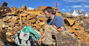 Data Acquisition
We provide comprehensive technical support at every stage of your field geophysical campaign — from logistics and operational management to data acquisition and crew supervision.
Data Acquisition
Data Acquisition
We provide comprehensive technical support at every stage of your field geophysical campaign — from logistics and operational management to data acquisition and crew supervision.
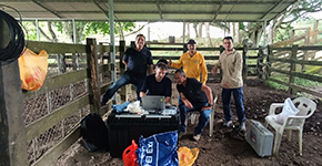 Training
On-site or remote courses, hands-on exercises, and crew ramp-up for consistent, repeatable results.
Training
Training
On-site or remote courses, hands-on exercises, and crew ramp-up for consistent, repeatable results.
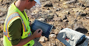 Data Processing
We deliver advanced field data processing and cleaning, including quality control and assessment, denoising, inversion, and preparation of geophysical maps.
Data Processing
Data Processing
We deliver advanced field data processing and cleaning, including quality control and assessment, denoising, inversion, and preparation of geophysical maps.
